Understanding the Youtube War
Since international news media was banned in Syria, the social media platform YouTube has become a primary source for transmitting footage of the Syrian Civil War. YouTube has become a war zone of all its own as competing groups use the platform to further their political interests on the battlefield. The importance of YouTube to the conflict is directly related to the prevalence of recording devices among citizens living in war-ravaged areas, as well as the politically murky nature of the Civil War.
This project is an investigation of the YouTube war, investigating the platform as a means to better understand the physical destruction and humanitarian crisis in the city. While the maps we have access to, as well as the data collected by UNOSAT and Human Rights watch, is viewable by us on high resolution satellite imagery, YouTube allows us to look closely at th ewar from another perspective of distance. What follows, of course, are many questions about the spatial relevance and political meaning of the ‘YouTube War.’
The Dynamics of War in Social Media
The videos uploaded to YouTube - and the political actors which these videos represent - are mediated by YouTube’s online platform. The platform’s structure for sharing and consuming videos has set a context through which the narrative of the conflict has evolved.
Beyond a curated front page, Youtube’s familiar interface is fairly standard across digital media platforms; a search term delivers a list of twenty results on a white background. The order of this list is determined by youtube’s search algorithm and can be modified by the viewer using several filter options, including content type, upload date, and a sorting category, prioritizing videos by relevance, upload date, view count, or rating. Each video or group of videos shown in the resulting list includes an image, title, author, the amount of time since the video was uploaded, the number of views, and a two line description of the contents. The limited display of information for any one video in the interface prioritizes the list of videos from a search over the content within a single result.
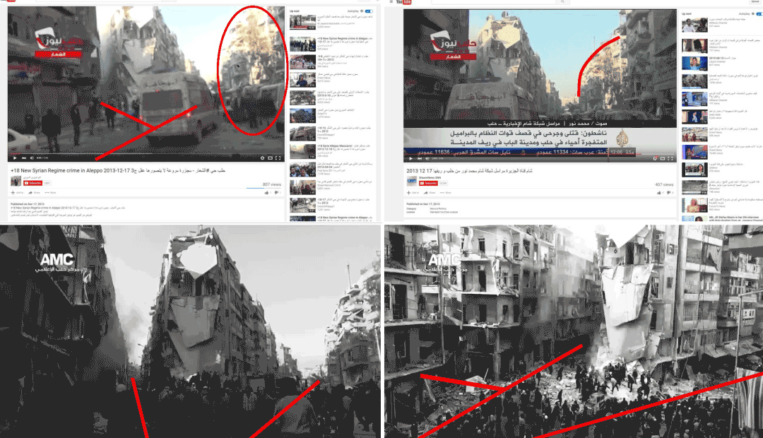
Within the context of YouTube’s existing platform, users uploading videos have developed a common method for categorizing content so that it is more easily accessible given the YouTube’s search-based interface. Videos uploaded of events on the ground in Syria are titled with a formula of location and date, in addition to a specific description of the event. This common language of describing videos transforms YouTube’s general search algorithm into an archive of war footage with great depth. A YouTube search of ‘حلب الشيخ خضر برميل’ [Aleppo Sheikh Kheder (a neighborhood in eastern Aleppo) barrel], on July 6th, 2016, for example, returns 2,510 results.
The question of place as it corresponds to the locations referenced in videos is an open question in our research. In the videos we have seen over the course of our research, place is often referenced as the neighborhood of the event. However this is not always the case. Some neighborhoods in the center of the city are referred to as the “Citadel” (القلعة). Other events are tied to particular known spaces, such as intersections or open spaces. One building, the tower of Aleppo’s city hall, functions as a major point of conflict between rebel groups and the Syrian regime and is used as a placement to locate videos.
Mapping the YouTube War
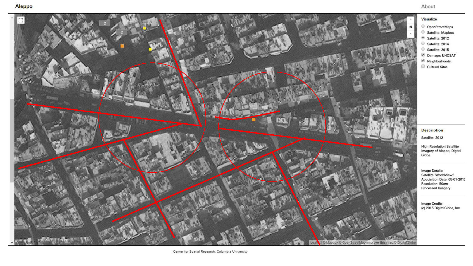
While YouTube is an important resource for accessing and distributing footage of the Syrian Civil War, it’s platform does not give access to the spatial dynamic of the conflict. The below map plots youtube search results across a map of Aleppo, taking advantage of the naming conventions which have become the standard of accessing first person content.* Videos are located on the map corresponding to the searches for the place names used in the video titles. Filters corresponding to other common keywords can be turned on and off to further specify the videos shown. *An appearance of videos on these maps does not indicate that they are confirmed or collaborated.
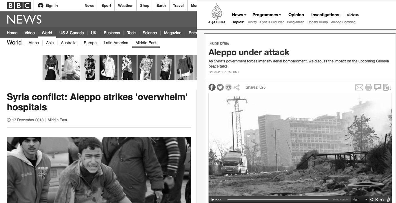 Left: BBC Nnews.
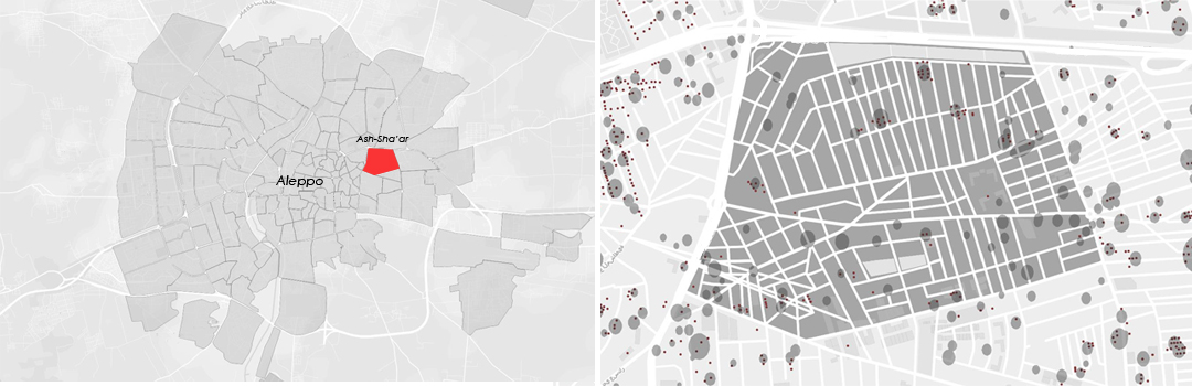
 Al Jazeera.
 Digital Globe.
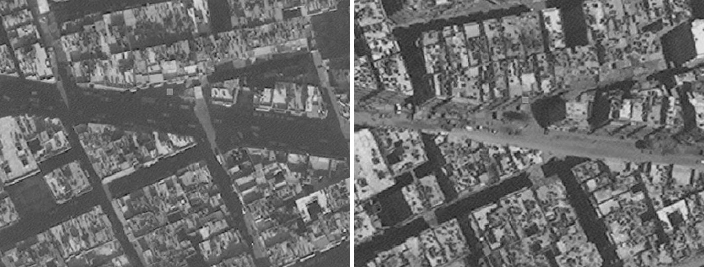 Left: Digital Globe.
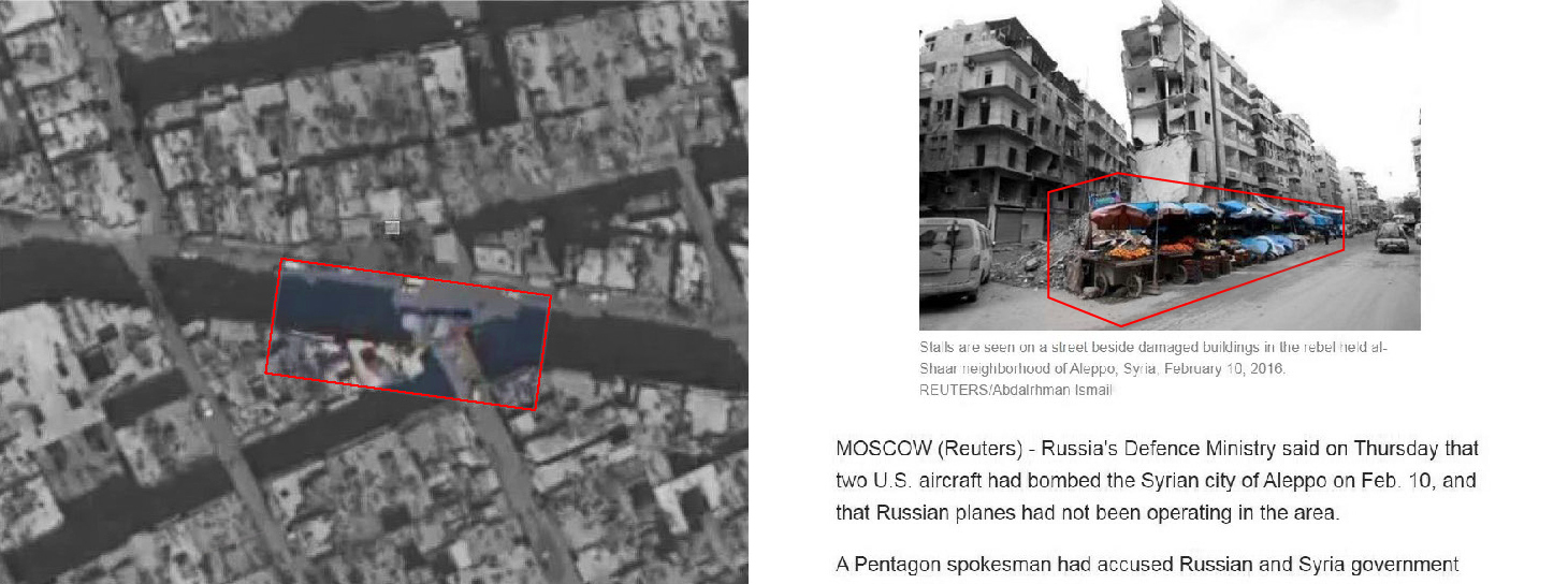 Left: Aleppo, Airbus.
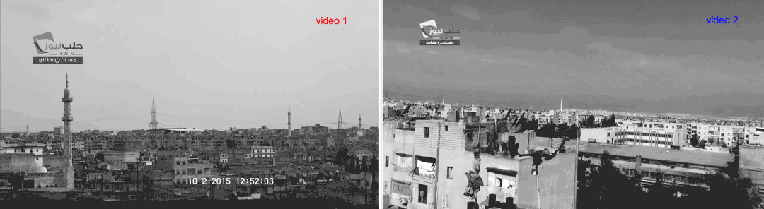 Left: H.N.N.
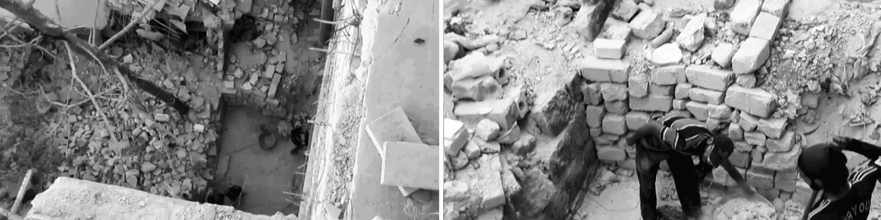
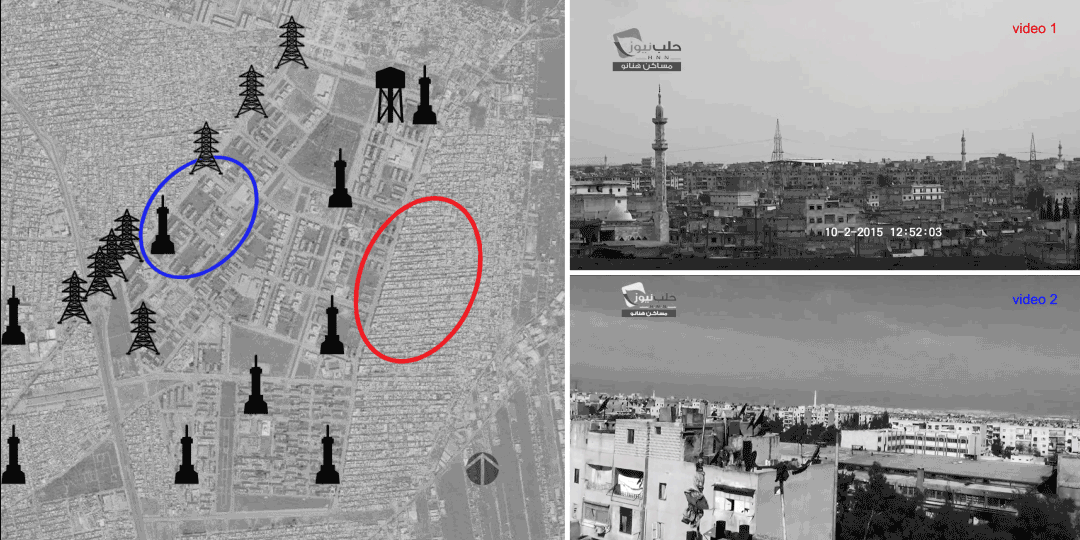 Above: H.N.N.